


2026-10-23 03:06:12
Mathematician and Cornell professor Steven Strogatz was a guest on NYT’s Daily podcast to talk about the recent developments in Mathematics. Well, it starts out that way, and then Strogatz gets into purpose and touches on deeper feelings that many of us are getting to know.
Tags: math, New York Times, purpose, Steven Strogatz
2026-10-23 00:45:14
This is No. 411 of the Process, where we focus on the finer bits of visualizing data. This week, we switch the chart defaults to non-defaults.
Become a member for access to this — plus tutorials, courses, and guides.
2026-10-22 17:13:33
If your electricity provider is an investor-owned company, it’s likely you’re paying more than someone with a public provider. For Bloomberg Green, Michelle Ma and Nadja Popovich highlight the difference:
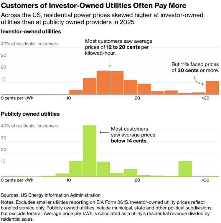
Estimates are based on data from the Annual Electric Power Industry Report published by the U.S. Energy Information Administration.
Tags: Bloomberg, cost, electricity
2026-10-21 15:30:21
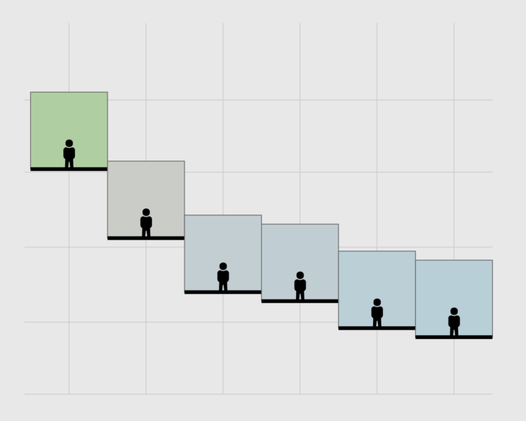
Results from the Survey of Consumer Finances were recently released, which means it is time for a rendition of seeing who has a higher net worth than you.
2026-10-20 17:36:27
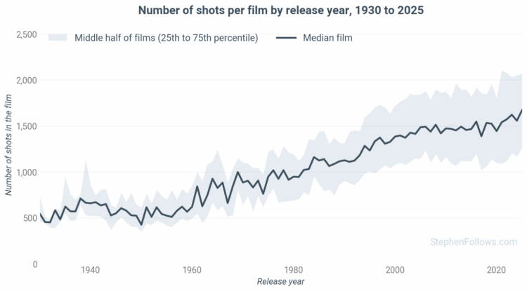
Stephen Follows counted the number of shots in movies, from 1920 through 2025. The overall number of shots increased, and so has the range.
Between the 1930s and 1950s, films averaged between 550 and 580 shots. The median started to climb in the 1960s and didn’t slow until the current century. In recent years, the increase has been minimal, sitting at 1,479 for the 2010s and currently 1,559 for the first half of the 2020s.
Follows used TransNet V2 for transition detection and shot count.
Tags: movies, shots, Stephen Follows
2026-10-19 18:02:56
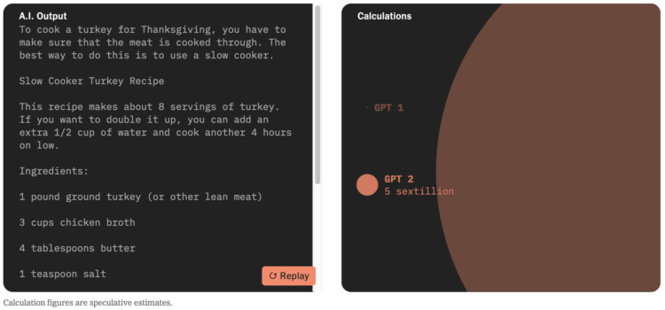
More big numbers coming in. For NYT’s the Upshot, Aatish Bhatia demonstrates the millions of trillions (octillions!) of calculations required for training AI.
During its training, the A.I. is fed a portion of a sentence, and the knobs are adjusted using a series of math calculations to improve its guesses for the next word. This process is then repeated over trillions of words of training data.
It takes only a few additions and multiplications to adjust a single knob. But when trillions of knobs are adjusted trillions of times, the math quickly adds up.
And this is just the first step in training a language model, known as pre-training. It’s followed by additional steps of calculations that hone the A.I.’s behavior and improve its ability to code and solve math problems.
All those calculations require energy, data, and time. The big companies are taking what they can get with the first two things in efforts to reduce the third.
Tags: Aatish Bhatia, calculations, scale, training, Upshot

